
Parsel Atlası user guide
Watch the 75-second video (Turkish voice-over), then follow the same steps in writing below.
75 seconds · Turkish voice-over · open in a new tab
- What we will do. Find a parcel, see its boundary on the map, open plan and protection layers, measure, and share the result or save it as PDF.
- Find the block and parcel number, download KML. The block (ada) and parcel numbers are on your title deed. Query them on the official TKGM Parcel Query page and download the result as KML. Parsel Atlası does not send queries to TKGM itself.
- Upload your file with “Ada / Parsel ile bul”. Open the window from the left map menu and drop the KML (or GeoJSON) file. The parcel appears with its boundary and details open in the side panel. KMZ is compressed; download as KML.
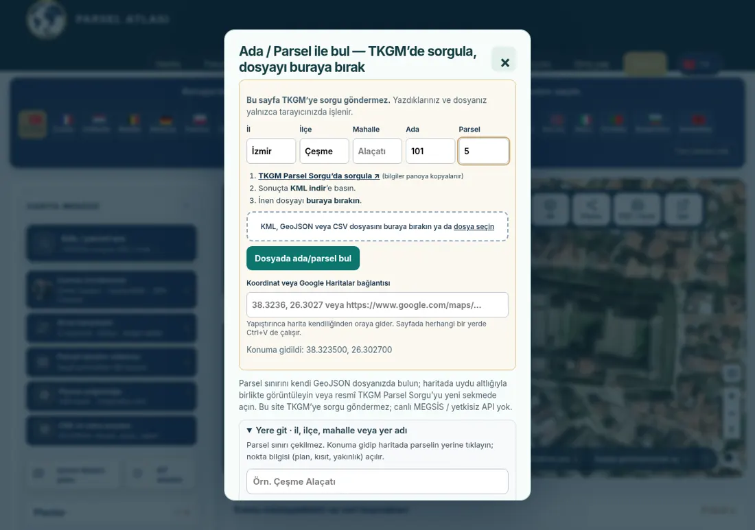
- No file? Go by place name or coordinates. Type a neighbourhood or place name and zoom in, or paste coordinates (e.g. 38.3236, 26.3027) or a long Google Maps link into the coordinate field.
- Environmental plan on the right. The map opens in split screen: satellite on the left, ÇDP (environmental plan) on the right. Close the right panel to work in a single view.
- Turn on layers. From the Layers (Katmanlar) menu, switch zoning plan, SİT areas, coastline, forest and pasture layers on and off. The zoning layer appears only when zoomed in.
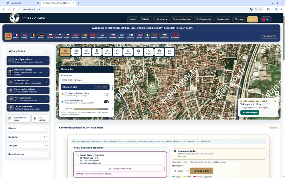
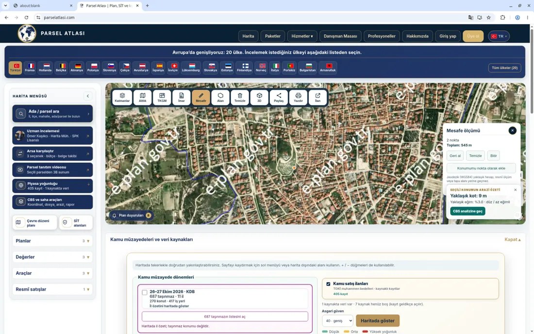
- Elevation, slope and measuring. Tap the map for approximate elevation and slope; use the distance and area tools to measure. Values are approximate.
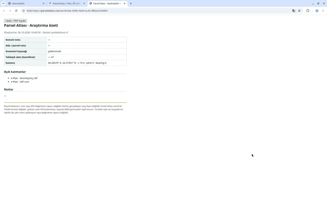
- Share or save as PDF. “Paylaş” gives a link to your view; “PDF / Yazdır” opens a printable research summary you can save as PDF.
- More detail. For a detailed surroundings report or a review by a surveyor and valuation expert, see packages & prices.
Frequently asked questions
Where do I find my block and parcel number?
On your title deed. You can also find it in the title-deed service on e-Devlet or ask the seller or agent.
What is KML?
A map file format that carries points and boundaries (also used by Google Earth). The KML from TKGM Parcel Query contains your parcel boundary.
Why can't I see the zoning layer?
It loads only at close zoom. Some areas may have no zoning data.
What is ÇDP?
The Environmental Plan (Çevre Düzeni Planı) is a regional-scale plan showing general land-use decisions. More detailed zoning plans set the building conditions of a parcel.
Does Parsel Atlası query TKGM automatically?
No. You run the query on TKGM's official page and drop the downloaded file into Parsel Atlası.
This information is for guidance only and does not replace official documents. Obtain official documents from the municipality, land registry office and relevant institutions.